
How it works
Plan a sunset hike in three steps
- 1
Work back from the sunset time
Look up tonight's sunset for your spot, not just your town, then subtract the walk up and a 20-minute cushion so you arrive in golden light.
- 2
Count the walk down as night walking
Light fades fast after sunset. Civil twilight, the stretch when you can usually see without a lamp, lasts about 21 minutes near the equator and 28 minutes around New York at the equinox, according to timeanddate.
- 3
Pack for the dark half
A headlamp, warm layers and a way to find the trail matter more on the way down than on the way up.
Plan the descent first. The view takes care of itself.
The tool
When should you start a sunset hike?
Start early enough to reach your viewpoint about 20 minutes before sunset, and assume you'll walk down in the dark. If the walk down takes longer than civil twilight lasts where you are, about 20 to 45 minutes depending on latitude and season, every person needs their own headlamp.
Leave-by timer
Twilight lengths are equinox figures from timeanddate. They run longer near midsummer and midwinter away from the equator, and a ridge or tall trees to the west can cut the light earlier.
Your sunset hike checklist
The base list, from the NPS Ten Essentials and the American Hiking Society.
Two sources sit behind the base list. The National Park Service's Ten Essentials says headlamps are the recommended light "because they are hands-free" and to pack extra batteries, including one for your phone. The American Hiking Society's June 2025 sunset hike guide adds one or two extra layers, bug spray for summer evenings, and telling someone where you're going and when you'll be back.
If the walk down is longer than twilight, every person carries a light.
Where Asterfold fits
Check the sunset time and direction from your exact spot
A town's sunset time is close, but the AHS guide's first tip is to choose a trail that faces west. Asterfold draws the Sun's real path for any place and date, shows which way it sets, and lists golden hour and blue hour. Save the viewpoint, then plan the session with notes, gear, a reminder and a short checklist, and open the spot in Maps when it's time to go.
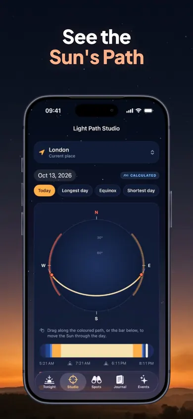
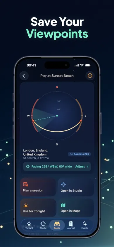
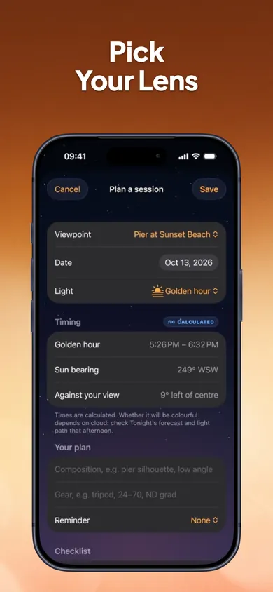
One design decision: the timer above asks for your own walking times instead of guessing from distance. A trail sign's estimate means little when someone is six.
Fair warning
Who should pick something else
- You need trail directions. Asterfold has no trail maps, routes or hiking times. Pair it with a map you trust, downloaded for offline use.
- Your viewpoint has mountains to the west. Asterfold's Sun positions assume a flat horizon; hills, buildings and trees are not modelled, so the Sun may disappear earlier than the listed time.
- You want long-range forecasts for free. Free covers tonight and the next 3 evenings. The 10-day outlook is in Asterfold Plus, an optional subscription.
- You're on Android. Asterfold is iPhone only.
What each tool tells you
Sunset hike planning apps, side by side
A weather app
Sunset time for your town, rain and wind. Usually no direction, no golden or blue hour, nothing about your viewpoint.
A trail app
The route, distance and elevation. Your best tool for getting up and down, but it won't tell you where the Sun meets the horizon.
Asterfold
The Sun's path and bearing from a saved spot, golden and blue hour, low, mid and high cloud toward the sunset, and a plan with a checklist.
Use a trail app to get there and Asterfold to know when and where to look.
Know the minute before you lace up.
Save your viewpoint, see tonight's golden hour and blue hour, and keep your checklist with the plan.